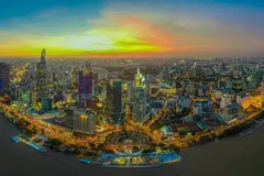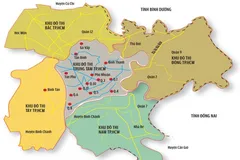
Plans were shelved for many years because of various infrastructure bottlenecks, limited connectivity of the Southern region with the City center, and the Hiep Phuoc port cluster due to sedimentation of the Soai Rap river bed.
Facilities in Ganh Rai Bay
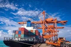
Now, the regional landscape is starting to change. East of Can Gio, along the Thi Vai river and the East bank of Ganh Rai Bay in Ba Ria-Vung Tau province, a leading port-heavy industry-energy hub is being formed. It will have the largest deep-water port in Vietnam, a heavy industrial cluster in Phu My, a Long Son petrochemical center which is under construction, and a maritime industrial cluster in Vung Tau. There will also be naval industrial facilities and an aquaculture cluster around Go Gang Island. A marine economic center there will also serve as a foundation for Vietnam to become a great maritime nation.
To the west of Ganh Rai Bay, on the side of Can Thanh, the district capital of Can Gio is still a quiet town which is facing many difficulties. The reason is that the traffic connection from Can Gio to the center of Ho Chi Minh City is rather limited, and the land is not suitable for agriculture either. Furthermore, the land bank is meagre due to natural conditions, but if you look at what is happening in Ba Ria-Vung Tau, you can see another future shaping it as the most important bay area in the South.
Possibly, Ganh Rai Bay could someday become like the San Francisco Bay Area in the US, which is now a world-leading education and technology center, but still retains nearly 18,000 hectares of natural reserve South of the bay. Ganh Rai Bay can also become like IJmeer Bay, East of Amsterdam in the Netherlands, where Almere is completely rebuilt on an artificial island of Flevoland to become the greenest city in the Netherlands. Ganh Rai Bay could also possibly one day be like Shenzhen Bay, between the economic zone of China and Hong Kong, one of the most prosperous bay areas with financial centers, technology zones, and a large deep-water port, which has still retained nearly 2,000 ha of waterfront nature reserve.
Slow response
Looking at the past history of Saigon, the new Ho Chi Minh City has always been hesitant in moving towards the sea. In its 150 year history, Saigon was a trading port since Admiral Page opened up international trade. The development of this trading port has always been constrained by indecisions of authorities. The first was the delay in transferring Saigon port from a river port to a sea port such as Singapore and Hong Kong. Then there was the failure to expand the railway network to the whole of Indochina and towards Bangkok, as originally planned by the Governor-General of Indochina, Paul Doumer.
During the Doi Moi period, Saigon port still inched slowly from Tan Cang to Khanh Hoi then Cat Lai and Hiep Phuoc ports, where the location in the City and the navigation channel were not deep enough for long-term development opportunities. In the century when island ports welcomed super-tonnage ships, Singapore encroached on the sea to build the Tuas super port in the West of the island nation, while Rotterdam encroached on the sea to build the Rotterdam World Gateway port that stretches nearly eight kilometres off the coast. The boldest move was made by Shanghai when it made Duong Son port by connecting three islands 33 kms from the mainland to become the world's largest port with capacity for 43 million containers, which is twice the volume of all Vietnamese seaports combined.
It is clear that the Southern region of Can Gio will serve Ho Chi Minh City as a better choice in international maritime connectivity, than Hiep Phuoc. Even the Cai Mep-Thi Vai deep-water port area along 13 kms of the riverbank does not have much land to expand and will not be able to accommodate super-tonnage ships.
Looking to the future, a cluster of ports in the South of Can Gio will no longer be alone between a vast area of forests and water. However, proposals for extremely large infrastructure systems have caused controversy and concern because of risk of socio-economic activity, environmental pollution and corruption. Planning does not mean that it will build in a day, but which requires a farsighted vision of twenty to thirty years, or even a hundred years. Every option should also be considered in protecting and optimizing opportunities for the future.
Farsighted planning
Can Gio has all the requirements to become more than just an eco-tourism hub because of its location in the West of Ganh Rai Bay and close to the main channel leading to the Long Tau and Thi Vai rivers. There is possibility to develop it as part tourism urban area, while the land South of Can Gio has not been fully exploited. We must look at Can Gio with a greater vision and greater aspiration.
We can learn from the development experiences of large-scale sea reclamation projects like Hulhumale in the Maldives. Can Gio can certainly become a maritime economic hub, and in the future, Can Gio will have a population of more than 300,000 people, equivalent to a grade-1 city like Vung Tau or My Tho. With such a population size, Can Gio needs to be planned as a future city, and not just a real estate project. The economy of Can Gio then should not and cannot rely solely on a few economic sectors such as tourism or real estate.
Can Gio has the natural conditions for a biosphere reserve, and has protected forest areas in the Southeast, which can be the basis for developing an economy based on environmental conservation for tourism, fisheries, real estate, and sustainable research. However, it must be a place that does not become alien for the existing local community, and hence must develop sustainably, uniquely, retain its identity, but also remain attractive to investors.
The challenges in the future are sure to be enormous. Not only are resources becoming scarcer by the day but also much more expensive, such as sand for levelling, which can make encroachment projects less attractive in terms of investment efficiency, but also create environmental challenges. Rising sea levels and increased intensity of storms caused by climate change will increase the cost of coastal protection and the cost of maintaining coastal structures.
Countries with solid coastal protection systems, such as the Netherlands or the United States, have now changed their approach and are shifting from reliance on hard infrastructure to integration with soft infrastructure and natural ecosystems. The Netherlands gradually accumulated sand dunes and planted more coastal forests to withstand the North Sea storms, while the US pumped more silt into the Mississippi estuary to expand existing mangrove areas which formed an effective shield for inland cities.
Can Gio development also needs a combination of hard infrastructure solutions that will be immediately effective, with natural solutions that are sustainable and long-term. Urban development now requires a combination of a diverse ecosystem that will create a unique landscape, and an attractive city in real estate.
Planning for a big vision takes a lot of effort. There will be many challenges in the proposed urban development and sea encroachment planning in Can Gio for experts, who will also have to decide what scale and development model would be suitable to adapt to the geological conditions, the sensitivity of the ecosystem, freshwater supply capacity, and sand leveling source. The geo-economic strategic position may explain the direction of development, but a new thorough and transparent research will help a rational strategy towards sustainable reality, including economics for investors.
Similar to what the Japanese did in Tokyo Bay, and what the South Koreans did in Incheon Bay, Can Gio can also do the same in Ganh Rai Bay. This is a great national opportunity in which just one investor cannot stand alone. There is now a greater need for coordination between regional governments, local governments, as well as the support of all communities and experts in the field of planning and implementation.


