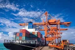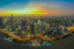
Even though Ho Chi Minh City has been developing into a commercial hub for the last 300 years, due to various reasons, the land strip along the Saigon River has not been exploited to its full potential.
Development suggestions
The Saigon River that flows along and within Ho Chi Minh City covers a length of 80kms. However, the parts and areas that could be exploited cover about 65kms, from the foot of the Saigon bridge to Ben Duoc and Cu Chi Districts, passing through District 1, Binh Thanh, District 12, and Hoc Mon. During a press conference in February on the current socio-economic situation, leaders of Ho Chi Minh City asked investors, scientists, and the media on suggestions to utilise the Saigon Riverbed area for better sustainable development.
Earlier in 2017, one corporation had proposed a project called the Saigon Riverside Boulevard. This was to be a fast-traffic road along the Saigon River with six lanes, for speed of 80km to 100km per hour. This corporation offered to implement the project under the BT model plan, at a capital investment of VND 64,000 bn. In return, Ho Chi Minh City was to assign 12,400 hectares of clean land for the building of this urban traffic lane. The important issue here is that such a model for this urban strip would have unpredictable consequences, which could cause great losses that would be difficult to overcome.
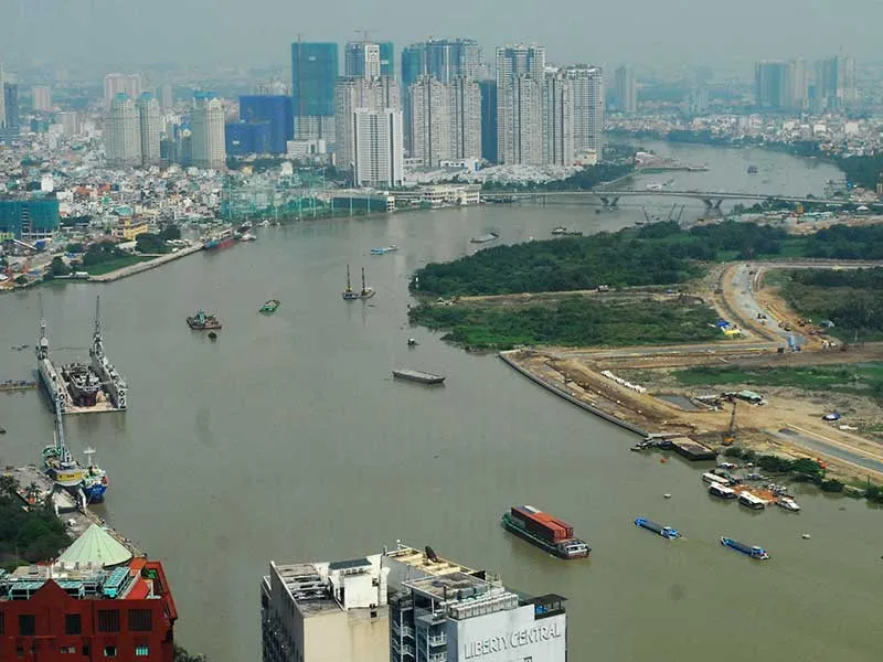
For any future development along the riverbed, we must understand the Saigon River. The Saigon River is not as straight as the Red River, the Tien River, the Moscow River in Russia, the Seine in France, or the Chao Phraya in Thailand, but it is a meandering river. There are many sharp turns such as in Ben Duoc and Ben Suc, and at many places there are arc formation as in Thanh Da, Thao Dien, and Thu Thiem.
The Saigon River flows quite smoothly but is greatly affected by the tide, so the water rises and flows onto banks during high tide. The strip of land adjacent to the riverbank is soft soil, and in many places this soil heap is caused by alluvial deposition, which easily subsides. There are also many underground water sources, water pockets, and mud bags below the flowing river, so the dyke sections made of plain soil often break down in the rainy season. Such river formation is naturally formed over thousands of years, so traffic lanes on such areas are not practical.
If we make a fast traffic road with six lanes stretching nearly 70km with concrete or hot asphalt, for trucks and super-heavy vehicles, the load and friction along the riverbank will subside the entire land strip. Therefore, it is necessary to make hard rock embankments throughout the route. In many places, the river has to be encroached and straightened along banks, to make it convenient for fast traffic.
However, this change will cause the water to flow faster, cause erosion, create a cleft, and lead to friction on the opposite bank in Binh Duong province, which could also subside. Changing the direction of water flow can also cause gradual soil erosion. If at the same time heavy rain, high tide, and discharge water from Dau Tieng flows it will probably flood most of Thanh Da, Thao Dien, and Thu Thiem. Besides, this strong river flow could also affect the foundation of Binh Trieu bridge, Saigon bridge, Thu Thiem 1 and Thu Thiem 2 bridges and Thu Thiem tunnel.
Currently, along the Saigon River, there are 56 projects encroaching on the river, including a project on about 14 hectares of land, extending for more than 1km distance. If this situation continues, the river will become stressed. In particular, if only one side of the riverbed is developed it will cause stress along Dong Nai and Binh Duong also. However, so much riverbank reclamation will change the appearance of the Saigon River, which will be great for Ho Chi Minh City. It can be as beautiful as the Huangpu River of Shanghai, the Han River of Seoul, the Seine of Paris, and the Chao Phraya of Bangkok.
Urban riverbed area
The plan to create a highway to shorten the travel time from the city center to Cu Chi is not very favorable. Based on topography, geomorphology, geology as well as environmental landscape, the formation of a river-ecological urban strip is the most reasonable. Therefore, the main traffic here should be water transport using canoes, boats, buses, and river ferries, which are all necessary. Maybe a few sections of road traffic can also be developed along with this, for only about two lanes.
In fact, water transport, if exploited well, brings about equally or even higher efficiency than road traffic. Therefore, along the Saigon River, there can be docks for boats and berths for boarding and disembarking passengers and goods, each of which will become urban nodes combining traffic with business, commerce, and tourism.
Such an urban strip will not be suitable for high-rise buildings, tube townhouses, or shops along the road like the inner city streets that are designed between houses and public buildings. It will have public utilities such as offices, supermarkets, schools, parks, trees, lawns, and flower gardens. The urban strip will be full of lush green trees along the water surface. This urban strip will not be narrow but wider with orchards, craft villages, fruit and vegetable villages, like inner residential areas of Hoc Mon and Cu Chi, creating an ecological and cultural urban strip. Its vitality will reflect the peaceful surroundings reminiscent of agriculture, rural areas, and farms. It will also reflect river cultural tourism, with home stays in southern garden houses along the river which will attract foreign tourists.
This particular urban strip is low on the outer side of the river and gradually rises towards the river, and there are high-rise buildings close to the riverbed along the Ba Son and Tan Cang areas. This strip of land is mainly a public space suitable for making ecological parks, flower gardens, walking gardens, but not for making hard embankments. Currently this area has cafes and restaurants, mostly of unstable construction, and dockyards for passenger ships, beside traditional riverside markets.


